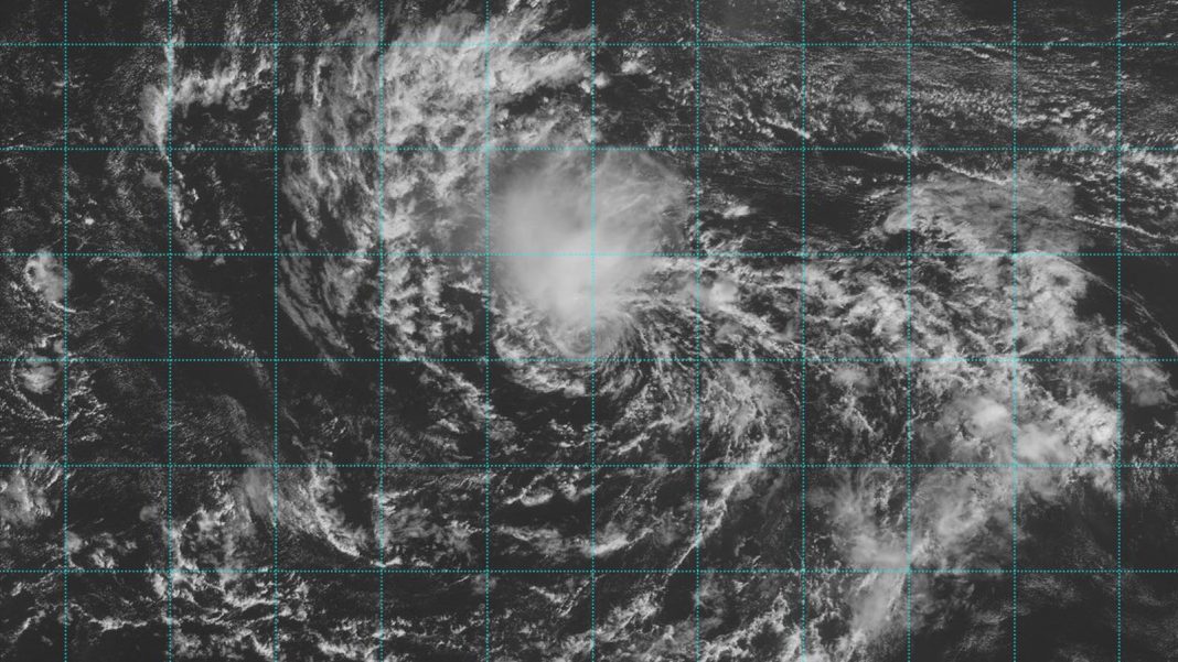
Hurricane activity in the Atlantic typically ramps down sharply by the time late October rolls around. On average, only 14% of the Atlantic season’s activity occurs from October 15 onward (as measured by accumulated cyclone energy). This year may not be so quick to turn quiet, though. One disturbance will be approaching the Leeward Islands by late week and another may take shape in the western Caribbean a few days from now.
The hyperactive Atlantic season of 2020 is a relevant reminder of what late October and November can do in a warming climate. Three major hurricanes roiled the Caribbean and Gulf of Mexico after October 15, with another (Epsilon) in the northwest Atlantic. Zeta, Eta, and Iota each made landfall in the Caribbean, and Zeta and Eta went on to strike the U.S. Gulf Coast. Iota was the year’s last named Atlantic storm; it’s also the last storm that will bear a Greek-letter name in the Atlantic, as the “overflow” list of Greek letters (created for use when a season had already gone through all 21 of its assigned names but not adopted with name retirements in mind) was replaced by a new supplemental list in 2021.
A strengthening La Niña event in 2020 helped nurture the late-season activity, as did unusually warm sea surface temperatures. This October, La Niña appears to be taking shape once more, and despite the recent raging of Helene and Milton, the average sea surface temperature across the Gulf of Mexico remains at record warmth for the date. The Atlantic has certainly been active since the climatological midpoint of the season (around September 10), bringing a year that had fallen behind the usual pace solidly into the busier-than-average category.
So far this year, the Atlantic has had 13 named storms, nine hurricanes, four major hurricanes, and an accumulated cyclone energy, or ACE, index of 141. The averages for this date are 12 named storms, six hurricanes, three major hurricanes, and an ACE index of 106. The long-term averages for the period 1991-2020 for an entire season were 14.4 named storms, 7.2 hurricanes, 3.2 major hurricanes, and an ACE index of 123.

A late-season Cabo Verde wave needs to be watched
Late October is well past the normal season for Cabo Verde disturbances – those that traverse the Main Development Region of the tropical Atlantic and can affect the Caribbean as well as Central and North America as long-track hurricanes. This year, the Main Development Region is roughly tied with 2023 at record warmth for the date (about 0.5 degree Celsius or 1°F warmer than all preceding years).
A Cabo Verde disturbance in the central Atlantic, dubbed Invest 94L, will be heading westward through midweek. On Monday, the disturbance had a well-defined surface circulation but was embedded in a very dry air mass, keeping heavy thunderstorm activity limited, as seen on satellite loops. But by Wednesday and Thursday, 94L will be traveling over record-warm sea surface temperatures of around 28 degrees Celsius (82°F). Wind shear is projected by the SHIPS model to be light, 5-10 knots, and the midlevel atmosphere should gradually moisten (relative humidity increasing from around 40% to greater than 50%). Although tropical cyclones in this location so late in the season would normally be expected to recurve away from land, an unusually strong subtropical ridge of high pressure will keep 94L heading generally westward, potentially allowing the disturbance to bring heavy rains to the northern Leeward Islands on Friday.


By early next week, 94L will have two major impediments to development: a wall of hostile wind shear if it tries to move to the west-northwest toward Florida (Fig. 2), or the imposing mountains of Hispaniola if the disturbance moves more to the west-southwest over the Dominican Republic. It is unlikely that 94L will affect the U.S. East Coast. As discussed by Michael Lowry in his Monday Substack post, historically, hurricanes that hit the mainland U.S. this late in the season have come from the western Caribbean, not the Atlantic. Only four U.S. hurricane hits beyond mid-October have originated from systems forming east or north of the Caribbean: Unnamed (1887), Hazel (1954), Kate (1985), and Nicole (2022).
In its 8 a.m. EDT Monday Tropical Weather Outlook, the National Hurricane Center gave 94L a 10% and 50% chance of development in the two- and seven-day periods, respectively. The next name on the Atlantic list is Nadine.
The western Caribbean could spawn trouble by Thursday
An area of disturbed weather over the southwestern Caribbean is associated with a large area of low pressure known as a Central American Gyre. The GFS and European model ensembles show the possibility of a tropical disturbance capable of developing into a tropical depression that may spin off from the gyre near the coast of Nicaragua by Thursday. The disturbance would be likely to move west or west-northwest, bringing heavy rains to Central America and Mexico’s Yucatán Peninsula through early next week. The National Hurricane Center was not highlighting this as a threat for development in its 8 a.m. EDT Monday Tropical Weather Outlook, though.
Disabled impacted by #Milton, need help? Discapacitade impactade por Milton y necesita ayuda?
Call/text (llame) Disability & Disaster Hotline 800-626-4959 or hotline@disasterstrategies.org #HurricaneMilton #HuracanMillton #Disability #Disabled #Discapacidad #DisabilityTwitter pic.twitter.com/E7fpHRFmmC
— The Partnership for Inclusive Disaster Strategies (@disasterstrat) October 10, 2024
We help millions of people understand climate change and what to do about it. Help us reach even more people like you.


