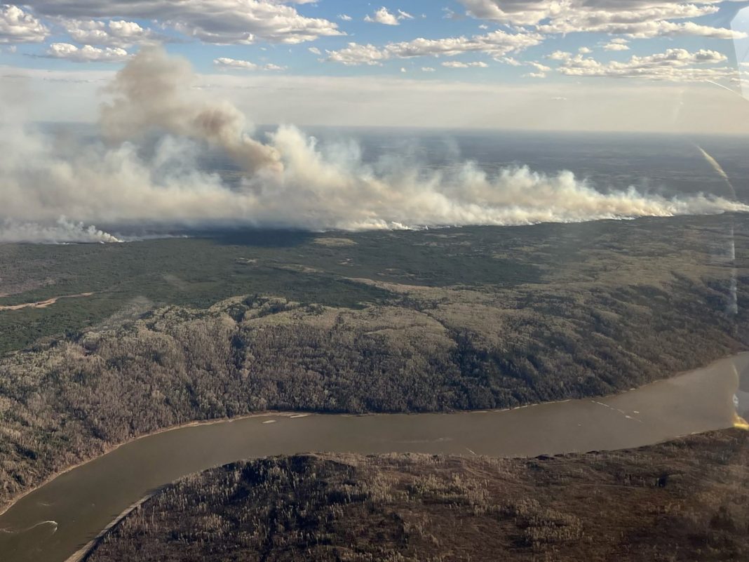
Authorities say firefighters are facing a ‘challenging day’ as a huge blaze nears Fort McMurray in the Alberta tar sands.
Authorities in the Canadian province of Alberta have issued evacuation orders for neighbourhoods in Fort McMurray, as a growing wildfire nears the community at the heart of Canada’s tar sands region.
The Regional Municipality of Wood Buffalo on Tuesday afternoon gave residents of the Abasand, Beacon Hill, Prairie Creek and Grayling Terrace areas about two hours to leave their homes due to an approaching wildfire.
“These neighbourhoods directly interface with where the fire could potentially spread. Regional Emergency Services will better be able to defend these neighbourhoods from wildfire if they are uninhabited and clear,” the municipality said.
Located about 430km (270 miles) northeast of Edmonton, Fort McMurray has experienced devastating wildfires before.
In 2016, tens of thousands of people were forced to flee as a huge blaze destroyed homes, businesses and other structures in the town.
Wildfire MWF017 has continued to experience growth, especially in the northeast. Firefighters will continue to work on establishing containment lines around this fire today. For more information on this fire: https://t.co/ANhyIyWgtt pic.twitter.com/biGLpz0iU6
— Alberta Wildfire (@AlbertaWildfire) May 14, 2024
The current wildfire – dubbed MWF107 – has grown to 9,602 hectares (23,700 acres) and is considered out of control, the province’s Alberta Wildfire agency said in an update on Tuesday. It was located about 15km (9 miles) southwest of Fort McMurray.
“Smoke is impacting visibility, and it is difficult to determine accurate distances at this time,” the agency said on Tuesday morning.
“Fire activity is increasing on the northeastern edge of the wildfire, driven by winds from the southwest. Smoke columns are developing. This will be a challenging day for firefighters.”
Canada saw its most intense fire season on record in 2023, as hundreds of wildfires burned in provinces and territories across the country.
The huge blazes forced thousands from their homes, destroyed entire communities and sent enormous plumes of smoke into the United States as well as Europe.
Experts say the climate crisis is largely responsible for the record-setting conflagrations. Higher temperatures have extended the Canadian wildfire season, which typically runs from the end of April until September or October.
It has also increased lightning, which is generally the cause of about half of all the blazes in the country.
Over the past few days, a few thousand people in Canada’s westernmost province of British Columbia were also evacuated from their homes after a huge wildfire broke out near the small town of Fort Nelson, in the province’s northeastern corner.
Known as the Parker Lake wildfire, the blaze in British Columbia could approach the town and the nearby Fort Nelson First Nation, as authorities warn of the risk of strong winds steering the flames.
But local media reported that Tuesday brought favourable weather conditions to the area.
Rob Fraser, the mayor of Northern Rockies Regional Municipality, which includes Fort Nelson, told CBC News on Tuesday morning that the weather was “very calm” and an overcast sky should help crews respond.
“As long as the wind doesn’t come up from the west, it won’t blow any closer to the town,” Fraser said.
Last week, the Canadian government said that meteorologists with Environment and Climate Change Canada had predicted “weather conditions for spring and summer 2024 that could lead to greater wildfire risks”.
“As we can expect with climate change, most parts of Canada have experienced warmer and drier spring conditions so far, with the added influence this year of El Nino,” the government said in a statement.
“Drought conditions are expected to persist in high-risk regions in May, including the southern regions of the prairie and western provinces.”


