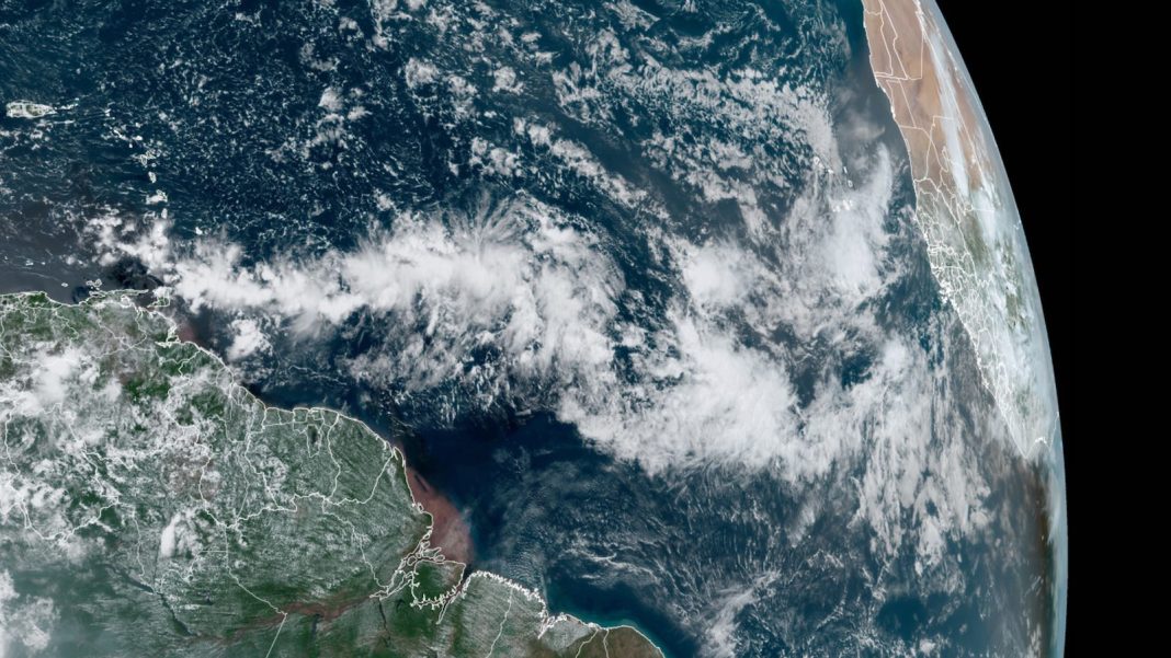
Labor Day weekend is typically one of the busiest times for hurricanes in the Atlantic, as we approach the September 10 midpoint of the season. But after an early-season burst of activity, which included the Atlantic’s earliest-ever Cat 5 (Beryl, on July 2), the tropics will be eerily quiet to start Labor Day weekend, with no active storms to track as of Friday. However, there is the potential that the season’s sixth named storm, Francine, could form in the Caribbean shortly after Labor Day. A reconaissance flight into this disturbance was tentatively scheduled for Sunday, September 1.

The precursor for the potential Francine might be a tropical disturbance located on Friday in the central tropical Atlantic, midway between the coast of Africa and the Lesser Antilles Islands. Satellite loops on Friday showed that the disturbance was disorganized, with a modest amount of heavy thunderstorm activity and not much spin. Conditions were modestly favorable for development, with moderate wind shear of 10-15 knots, a reasonably moist atmosphere, and near-record warm ocean waters of about 29 degrees Celsius (84°F). However, the disturbance was embedded in a wide swath of storminess across the eastern Atlantic called the intertropical convergence zone (ITCZ), and will need to separate away from the ITCZ and consolidate before development can begin in earnest.
The disturbance will be moving westward to west-northwestward at about 15 mph for the coming week, passing through the Lesser Antilles Islands on Monday and Tuesday. The longer-range track is uncertain, with most of the GFS model ensemble members predicting a more northwesterly track threatening Puerto Rico and the Dominican Republic; the European model ensembles (and the 12Z operational GFS model) favor a continued westerly motion, with the disturbance entering the central Caribbean near Jamaica on Thursday.
The disturbance has lukewarm enthusiasm for development from the 0Z, 6Z, and 12Z Friday runs of the GFS and European model ensembles, with fewer than half of their members showing development. In its Tropical Weather Outlook issued at 2 p.m. EDT Friday, August 30, the National Hurricane Center gave odds of 40% that development will occur in the next seven days over the western tropical Atlantic, with near-zero odds in the next two days. A separate disturbance just off the coast of Africa was being given 2-day and 7-day odds of development of 0% and 20%, respectively. This second disturbance was expected to move more to the west-northwest and is unlikely to be a threat to the Caribbean Islands.
A third area of interest is in the northwest Gulf, where a weak disturbance and associated trough of low pressure are expected to linger near or just off the U.S. Gulf Coast over the next few days. The 2 p.m. EDT Friday tropical outlook added 2- and 7-day odds of development of 10% and 20% for this system. Regardless of whether it becomes a tropical cyclone, this system will spawn periods of heavy showers and thunderstorms along and near the Texas, Louisiana, and Mississippi coastlines, especially from around Houston to New Orleans. Widespread 2- to 5-inch rains will douse the holiday weekend, and some localized totals of 10 inches or more can be expected.
It’s rare to have a Labor Day weekend without named storms around
In the two decades since Eye on the Storm was launched as “Dr. Jeff Masters’ Wunderblog” at Weather Underground in 2005, just three out of 20 Labor Day weekends (Fri-Sun) have been entirely free of named storms that were at least tropical storm strength over that weekend, as shown in the list below. Of course, the list is a crude measure of what was actually happening. Some of these named storms were harmlessly recurving in the Atlantic over Labor Day weekend. In other cases, a disturbance or tropical depression soon to become a named storm was already being tracked, such as 2006’s Hurricane Florence, which was named early on Tuesday, September 5, after two days as a tropical depression. In still other cases, high-impact hurricanes were winding down – e.g., Isaac in 2012, which was still spawning U.S. tornadoes while heading northward as a tropical depression and beyond. And over Labor Day weekend 2005, New Orleans was still caught in the grip of its horrific post-Katrina flooding catastrophe.
This year’s Labor Day weekend follows a prolonged pause in the Atlantic, ever since the demise of Hurricane Ernesto on August 20. We haven’t seen this distinct and lengthy a hiatus leading up to Labor Day for many years. In fact, as noted by hurricane expert Michael Lowry, the two-week period from August 20 to September 3 has included at least one Atlantic tropical or subtropical system in every year since 1956. One of the longest breaks of recent years was in 2013, when the Atlantic went from August 26 to September 4 without any active tropical cyclones.
Here are the named Atlantic storms in existence as tropical storms or hurricanes over 3-day Labor Day weekends (Friday night to Monday night, midnight EDT) since 2005, including peak lifetime strengths (compiled with the help of Wikipedia’s superb annual summaries and timelines of Atlantic hurricane seasons)
- 2005 (9/3-9/5): Maria (C3), Nate (C1)
- 2006 (9/2-9/4): none
- 2007 (9/1-9/3): Felix (C5)
- 2008 (9/6-9/8): Hanna (C1), Ike (C4)
- 2009 (9/5-9/7): none
- 2010 (9/4-9/6): Earl (C4), Hermine (TS)
- 2011 (9/3-9/5): Katia (C4), unnamed (TS), Lee (TS)
- 2012 (9/1-9/3): Kirk (C2), Leslie (C1), Michael (C3)
- 2013 (8/31-9/2): none
- 2014 (8/30-9/1): Dolly (TS)
- 2015 (9/5-9/7): Fred (C1), Grace (TS)
- 2016 (9/3-9/5): Hermine (C1)
- 2017 (9/2-9/4): Irma (C5)
- 2018 (9/1-9/3): Florence (C4), Gordon (TS)
- 2019 (8/31-9/2): Dorian (C5)
- 2020 (9/5-9/7): Paulette (C2)
- 2021 (9/4-9/6): Larry (C3)
- 2022 (9/3-9/5): Danielle (C1), Earl (C2)
- 2023 (9/2-9/4): Katia (TS), Gert (TS)
We help millions of people understand climate change and what to do about it. Help us reach even more people like you.


